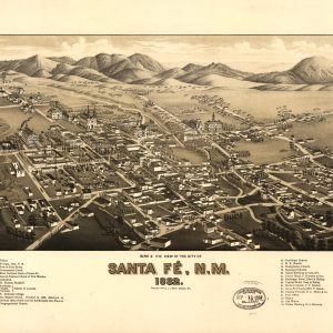
This beautiful antique map reproduction is printed on heavy acid-free stock with fade proof inks and is excellent for framing. Copyright 1882, J.J. Stoner Size: 24 × 15 This map features detailed drawings of historic structures, street names, and index listings identifying 30 significant buildings.
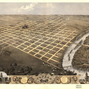
This beautiful antique map reproduction of the capital city of Kansas is printed on heavy acid-free stock with fade proof inks and is excellent for framing. Copyright Chicago Lithographing Co., 1869 Size: 28 × 22
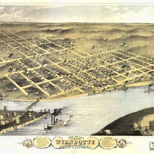
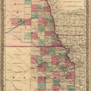
This beautiful antique map reproduction is printed on heavy acid-free stock with fade proof inks and is excellent for framing. Copyright Merchants Lith. Co., 1869 Size: 20 × 14
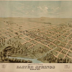
This beautiful antique map reproduction is printed on heavy acid-free stock with fade proof inks and is excellent for framing. Copyright Union Lith. Co., 1871 Size: 21 × 18
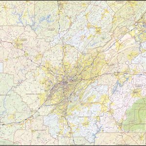
Our Birmingham Metro Area wall map shows a 180 mile wide by 130 mile high area centered on Birmingham, Alabama. It includes Jefferson County, Walker County, St. Clair County, Etowah County, Talladega County, Shelby County, and parts of Winston County, Cullman County, Blount County, Calhoun County, and Tuscaloosa County. Besides Birmingham, the communities of Gadsden,…
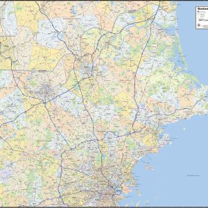
Our Boston North Shore wall maps shows the area from downtown Boston north to the New Hampshire state line, and from the coast west to include towns east of I-495. The map shows towns, counties, major highways and routes, as well as major points of interest. Note: due to the vast extent of this map,…
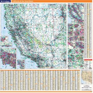
Laminated with Hanging Rails 60 W x 60 H Index of Counties and Cities Fully Indexed Counties, Cities, Mileage Chart Inset Maps of All Major Cities Coverage area includes all of California & Nevada and parts of AZ, CO, UT, ID, OR Free Shipping! This map is rolled and shipped in a sturdy cardboard tube.
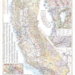
Few places in the world can claim such diverse landscapes and seascapes as California. This map illustrates The Golden State’s network of highways that grant road travelers access to iconic natural features like Death Valley, Lake Tahoe, Yosemite Valley, and the Coastal Redwoods to name a few. If outdoor adventure and recreation is your thing,…
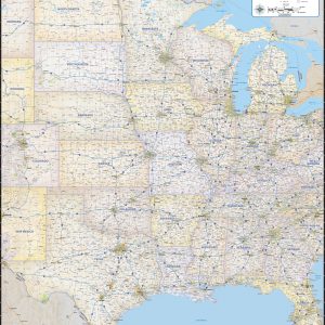
Our Central United States regional wall map shows the states of North Dakota, South Dakota, Nebraska, Kansas, Oklahoma, Texas, Minnesota, Wisconsin, Iowa, Missouri, Arkansas, Louisiana, Michigan, Illinois, Indiana, Ohio, Kentucky, Tenessee, Mississippi, Alabama, and Georgia. Features shown include states, cities, towns, counties, and major highways. The entire 21 state area from the Rockies to the…
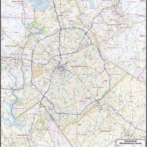
Our Charlotte and Mecklenburg County wall map shows a 35 mile by 40 mile area centered on Charlotte and Mecklenburg County, and also shows nearby areas of adjacent counties. The map shows towns, counties, major and secondary highways and routes, as well as major points of interest. Note: due to the vast extent of this…
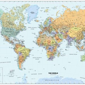
Paper or laminated National Capitals International Boundaries Major Physical Features Perfect for home, business, or school, this Classic World Wall Map combines warm, traditional colors with high-detailed cartography. Details on this World Wall Map include: international boundaries and nationalcapitals along with other major cities; major physical features such asmountain ranges, major mountain peaks, island chains, and…
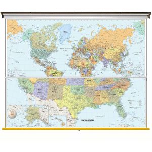
Size: 40 h x 63 w Finishing: Spring Roller Includes 2 Maps on One Spring Roller! Perfect for home, business, or school, this Classic USA Wall Map combines warm, attractive colors with high-detailed cartography. Details on this United States Wall Map include state boundaries and capitals along with other major cities and towns; major physical features such…
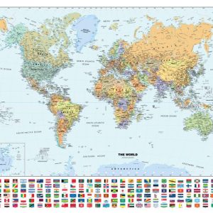
National Capitals and Flags International Boundaries Major Physical Features Perfect for home, business, or school, this Classic WorldWall Map with Flags combines warm, traditional colors with high-detailedcartography. Details on this World WallMap include: international boundariesand national capitals along with other major cities; major physical featuressuch as mountain ranges, major mountain peaks, island chains, and…
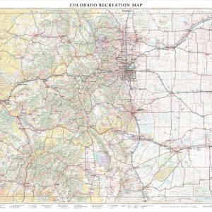
With its capital city Denver one mile above sea level (1,609 m), fifteen separate mountain ranges, and more than fifty peaks that reach above 14,000 ft (4,267 m), Colorado attracts travelers from around the world seeking their own “Rocky Mountain High” experience. This wall map illustrates The Centennial State’s vast network of highways and byways,…
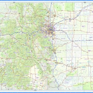
This exquisite wall map of Colorado uses shaded relief to portray the land and combines shading with elevation tints that portray landforms much more clearly than contour lines. These techniques and elevation colors make mountains, highlands and valleys immediately obvious. This map also includes a city index making this map both highly functional and decorative….
This beautiful antique map reproduction is printed on heavy acid-free stock with fade proof inks and is excellent for framing. The map features cities and towns, county boundaries, roads, and the railroad network. Copyright J.H. Colton & Co., 1855 Size: 17 × 27