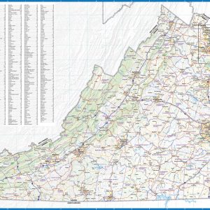
Wall map of Virginia, showing counties, towns, cities, villages, major roads and highways. A community index is included. This map comes in a variety of sizes and finishing options. It is shipped rolled in a sturdy cardboard tube.
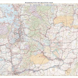
Washington features all the best natural landscapes of the Pacific Northwest, including skyscraping volcanic peaks, immense temperate forests, coastal wonders, inlet waterways, and manicured wine country. This wall map illustrates the public lands, scenic roadways, and recreation possibilities throughout The Evergreen State. If outdoor adventure and recreation is your thing, this is the map for…
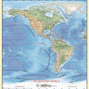
International Borders Physical Terrain Longitude and Latitude Beautifully illustrated with subtle earth tone hues, the detail is highly legible with country borders clearly defined. In classic Atlas style, this map can be used for general reference, to track current events, or as a piece of art.Decorators will find the color scheme works beautifully with most…
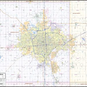
Our Wichita Metro Area regional wall map shows a 30 – 40 mile area centered on Wichita, Kansas. It includes most of Sedgwick County and western parts of Butler County. Besides Wichita, Park City, Bel Aire, Maize, Andover, Augusta, Douglas, Derby, Haysville, and Goddard are included. Features shown include cities, towns, counties, highways and major…
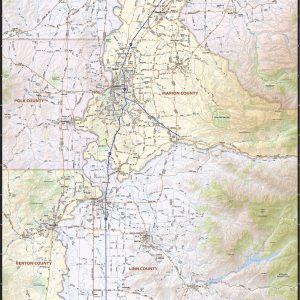
Our Willamette Valley wall map shows the entire 120 mile long Willamette Valley, from Portland in the north to Eugene in the south, including the cities of Albany, Corvallis, Lebanon, Salem, Woodburn, McMinnville, Oregon City, West Linn, and many others. The map shows towns, counties, major and secondary highways and routes, as well as major…
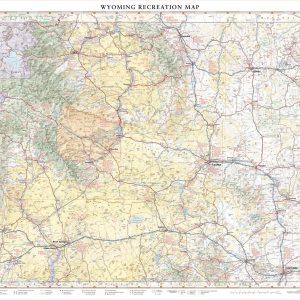
Wyoming is home to both Grand Teton and Yellowstone National Parks in its northwest corner, but there are more mountain ranges and rivers that extend beyond these iconic parks. This wall map illustrates The Cowboy State’s complete public land coverage and the scenic roadways that connect the Wind River Range to the Laramie Range, the…
Wall map of Wyoming, showing counties, towns, cities, major roads and highways. A community index is included. This map comes in a variety of sizes and finishing options. It is shipped rolled in a sturdy cardboard tube.