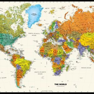
National Capitals International Boundaries Major Physical Features Perfect for home, business, or school, this Contemporary World Wall Map combines bright, attractive colors with high-detailed cartography. Details on this World WallMap include: international boundaries and national capitals along with other major cities; major physical features such as mountain ranges, major mountain peaks, island chains, and deserts; and major water…
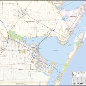
Our Corpus Christi Area wall map shows a 40 mile wide by 40 mile high area of south Texas. Besides Corpus Christi, the communities of Robstown, Odem, Sinton, Rockport, Ingleside, Portland, and Taft are shown. The map shows towns, counties, major and secondary highways and routes, as well as major points of interest. Note: due…
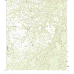
In 1879, the USGS began to map the Nation s topography. This mapping was done at different levels of detail in order to support various land use and other purposes. Current and historical versions for the entire United States are available here.The current versions are scaled at 1:24,000 also know as the 7.5 series. Each…
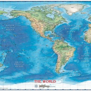
National Borders International Capitals Ocean Relief Beautifully illustrated with subtle earth tone hues, the detail is highlylegible with country borders clearly defined. In classic Atlas style, this mapcan be used for general reference, to track current events, or as a piece ofart. Decorators will find the color scheme works beautifully with mostfurniture and trim. This…
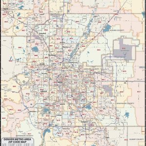
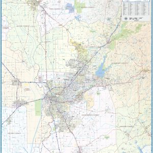
Our Denver Metro Area ZIP Code Map highlights zip code areas of Denver. The perfect tool for visualizing the big picture for the entire Denver Metro area, each zip code is colorized and labeled for quick identification. The map also shows counties, communities, and major roads. An index of zip codes is included for easy…
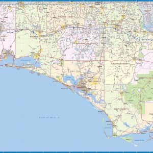
Our Florida Panhandle wall map shows the area from the Florida Alabama border in the west to Tallahassee in the east, including Pensacola, Navarre, Destin, Panama City, Port St. Joe, and Marianna, among others. Interstates, major highways and secondary roads are shown, as well as cities, counties, towns, and major points of interest. This map…
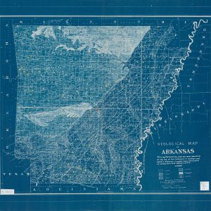
This beautiful antique blueprint-style map reproduction is printed on heavy acid-free stock with fade proof inks. It is excellent for framing. This map shows oil locations and drilling wells and the formation of the Cretaceous in southern and eastern Arkansas. Copyright S.T. Wisby & Co., 1920 Size: 32 × 27
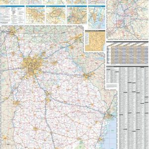
Laminated with Hanging Rails 46 W x 60 H Index of Counties and Cities Fully Indexed Counties, Cities, Mileage Chart Inset Maps of All Major Cities Free Shipping! This map is rolled and shipped in a sturdy cardboard tube.
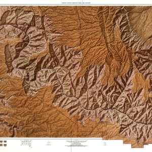
This beautiful antique map reproduction of the Grand Canyon and the mighty Colorado River is printed on heavy acid-free stock with fade proof inks. It is excellent for framing. Copyright U.S.G.S., 1972 Size: 50 × 31
Our Grand Rapids Metro Area wall map shows the area within 30 miles of downtown Grand Rapids , including the communities of Kentwood, Wyoming, Northview, Rockford, Muskegon, Grand Haven, Holland, Douglas, and Hastings, among others. All of Kent County and Ottawa County are shown, as well as adjacent areas of nearby counties. Features shown include…
Our Greater Boise Metro Area wall map shows a 50 mile wide by 35 mile high area centered on Boise, Idaho. It includes parts of Ada County and Jefferson County. It shows the communities of Boise, Garden City, Meridian, Nampa, Caldwell, and Eagle, among others. Features shown include cities, towns, counties, highways and major and…
Wall map of the Greater Portland Metro area showing locations within 20 miles of downtown Portland, including parts of Multnomah, Washington, Columbia, Clark, Clackamas, and Yamhill Counties. Communities included are Portland, Vancouver, Gresham, Beaverton, Aloha, Tigard, Hillsboro, Lake Oswego, Oregon City, Newberg, Canby, Saint Helens, and Forest Grove, among many others. Features shown include cities, towns,…
Wall map of the Greater Sacramento, CA area showing from Yuba City in the north to Galt in the south, and from Woodland Davis in the west to Placerville and Sutter Creek in the east. This area includes all or part of the following counties: Sacramento, Placer, Yolo, Amador, El Dorado, Sutter, Yuba, and Nevada….
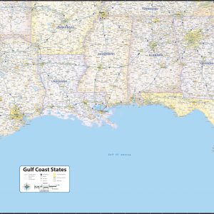
Our Gulf Coast States wall map shows the states of Louisiana, eastern Texas, southern Arkansas, Mississippi, Alabama, Georgia, western South Carolina, and Florida. Features shown include states. counties, cities, towns, and major highways. The entire Gulf Coast is shown, from Brownsville Texas to Florida. Includes new official name Gulf of America This map comes in…
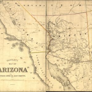
This beautiful 1865 map reproduction is printed on heavy acid-free stock with fade proof inks and is excellent for framing. Copyright William B. Hartley, 1865 Size: 37 × 31
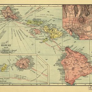
This beautiful antique map reproduction is printed on heavy acid-free stock with fade proof inks and is excellent for framing. Copyright 1912 Size: 14 × 11