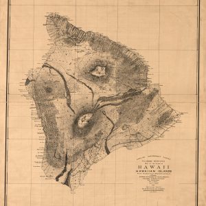
This beautiful antique map reproduction is printed on heavy acid-free stock with fade proof inks and is excellent for framing. Relief on the map is shown using hachures. Copyright Hawaiian Government Survey, 1886 Size: 28 × 32
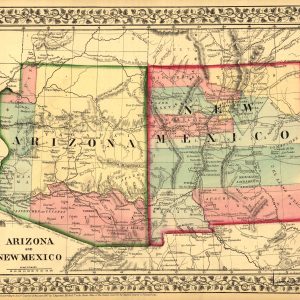
This beautiful antique map reproduction is printed on heavy acid-free stock with fade proof inks. It is excellent for framing. This colorful map features towns, mountain ranges, and rivers, colorful details, and a floral design on the edges. Copyright Mitchell, S. Augustus, 1867 Size: 15 × 12
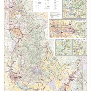
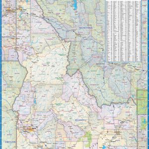
Idaho’s abundance of rare minerals, including the rare Star Garnet, earns it the nickname “The Gem State”. Idaho also boasts a wealth of mountain recreation and public lands including Craters of the Moon, Hells Canyon, the Sawtooth Mountains, and the western flanks of Yellowstone & Grand Teton National Parks. This wall map illustrates all the…
Wall map of Idaho, showing counties, towns, cities, villages, major roads and highways. A community index is included. Beautiful as well as functional this map will look great in a home, office, cabin, RV or wherever you choose to hang it. This map is rolled and shipped in a sturdy cardboard tube.
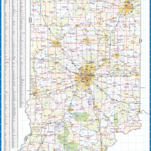
Laminated wall map of Indiana, showing counties, towns, cities, villages, major roads and highways. A community index is included. This map comes in a variety of sizes and finishing options. It is shipped rolled in a sturdy cardboard tube.
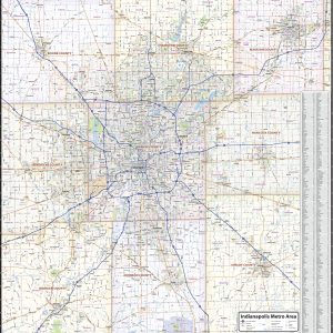
Our Indianapolis Metro Area wall map shows the area within 25 miles of downtown Indianapolis, Indiana, including Marion County and most of the counties of Boone, Hamilton, Madison, Hancock, Shelby, Johnson, Morgan, and Hendricks. The map shows towns, counties, major and secondary highways and routes, as well as major points of interest. Note: due to…
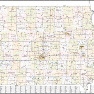
Wall map of Iowa, showing counties, towns, cities, villages, major roads and highways. A community index is included This map comes in a variety of sizes and finishing options. It is shipped rolled in a sturdy cardboard tube.
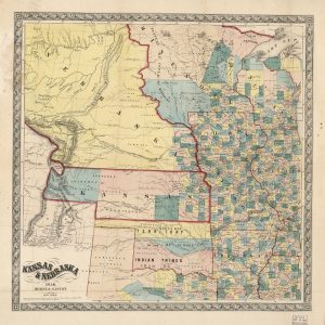
This beautiful antique map reproduction is printed on heavy acid-free stock with fade proof inks and is excellent for framing. The map also features Minnesota, Iowa, Missouri, Arkansas, Wisconsin, Illinois, and Native Territory. Relief on the map is shown using hachures. Copyright Morse & Gaston, 1856 Size: 23 × 23
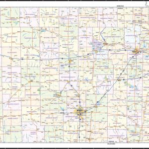
Kansas City Metro Area wall map, showing locations within 30 – 40 miles of downtown Kansas City. Information shown includes counties, towns, cities, major roads and highways, ZIP codes, and major points of interest. The area shown is from Lawrence, KS to Odessa, MO, and from Smithville to Harrisonville, MO. An index of community names…
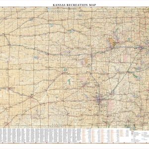
Kansas is best known for its rolling agricultural landscapes, which serve as host to a variety of flora and fauna. Fishing and migratory bird hunting are major recreational draws all year. This wall map beautifully illustrates the country roads that crisscross The Sunflower State, and the recreation opportunities that exist throughout. If outdoor adventure and…
Wall map of Kansas, showing counties, towns, cities, villages, major roads and highways. A community index is included. This map is rolled and shipped in a sturdy cardboard tube.
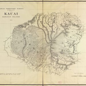
This beautiful antique map reproduction is printed on heavy acid-free stock with fade proof inks and is excellent for framing. Copyright Hawaii Territory Survey, 1903 Size: 47 × 37
Laminated wall map of Kentucky, showing counties, towns, cities, villages, major roads and highways. A community index is included. This map comes in a variety of sizes and finishing options. It is shipped rolled in a sturdy cardboard tube.
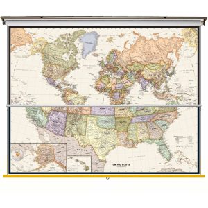
National Borders International Capitals Ocean Relief Introducing Compart Maps Colorful Legacy World USA Centered Wall Map. Beautifully illustrated with subtle antique parchment and earth tone hues, the detail is highly legible with country borders clearly defined. In classic Antique Atlas style, this map can be used for general reference, to track current events, or as…
Size: 40 h x 63 w Finishing: Spring Roller Includes 2 Maps on One Spring Roller! Perfect for home, business, or school, this Legacy USA Wall Map combines warm, attractive colors with high-detailed cartography. Details on this United States Wall Map include state boundaries and capitals along with other major cities and towns; major physical features such…
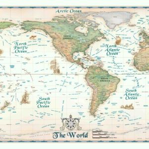
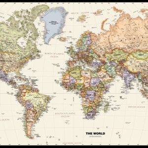
National Capitals International Boundaries Major Physical Features Perfect for home, business, or school, this Legacy World Wall Map combines bright, attractive colors with high-detailed cartography in an antique style. Details on this WorldWall Map include: international boundaries and national capitals along with other major cities; major physical features such as mountain ranges, major mountain peaks, island chains,…