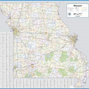
Wall map of Missouri, showing counties, towns, cities, villages, major roads and highways. A community index is included. This map comes in a variety of sizes and finishing options. It is shipped rolled in a sturdy cardboard tube.
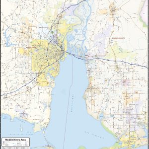
Our Mobile Metro Area wall map shows the area within 20 miles of downtown Mobile, including the communities of Daphne, Prichard, Chickasaw, Saraland, Tillmans Corner, Bayou La Batre, Gulf Shores, Foley, Robertsdale, and Bay Minette, among others. Features shown include cities, towns, counties, highways and major and secondary roads, zip codes, and major points of…
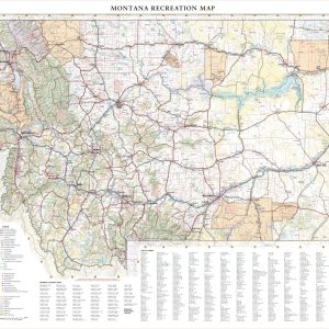
Montana covers a massive area (4th largest state in the USA) from its eastern Great Plains to the Rocky Mountains in the west. This wall map illustrates Big Sky County’s vast landscapes and scenic roads that connect world class destinations including Glacier and Yellowstone National Parks. If outdoor adventure and recreation is your thing, this…
Wall map of Montana, showing counties, towns, cities, villages, major roads and highways. A community index is included. This map comes in a variety of sizes and finishing options. It is shipped rolled in a sturdy cardboard tube.
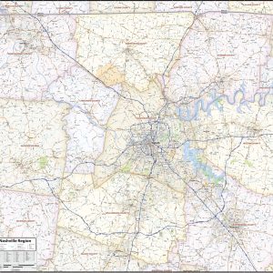
Wall map of the Nashville metro area, showing counties, towns, cities, villages, major roads and highways. Includes community index. This map comes in a variety of sizes and finishing options. It is shipped rolled in a sturdy cardboard tube.
Nebraska’s vast prairies and farm towns are surprisingly active with outdoor recreation and frequent festivals. The Platte River traverses the state from west to east, converging with the Missouri River near Omaha, making The Corn Husker State an annual hotspot for migratory birds along the Central Flyway including endangered whooping cranes. If outdoor adventure and…
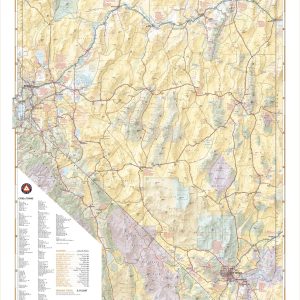
Nevada’s desert landscapes can seem desolate, but there are world-class recreation oases throughout including Great Basin National Park, Lake Tahoe, Las Vegas, and the Black Rock Desert. This wall map illustrates the diversity of public lands and roadways that make The Silver State a delight for travelers looking for something different. If outdoor adventure and…
Wall map of Nevada, showing counties, towns, cities, villages, major roads and highways. Includes community index. This map comes in a variety of sizes and finishing options. It is shipped rolled in a sturdy cardboard tube.
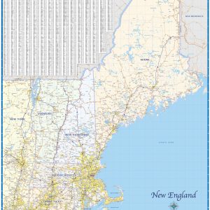
Regional road map covering the 6 New England states – Maine, Vermont, New Hampshire, Massachusetts, Connecticut, and Rhode Island. Features shown are cities, counties, major roads and highways. A city index is included. This map comes in a variety of sizes and finishing options. It is shipped rolled in a sturdy cardboard tube.
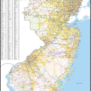
Wall map of New Jersey, showing counties, towns, cities, villages, major roads and highways. Includes community index. This map comes in a variety of sizes and finishing options. It is shipped rolled in a sturdy cardboard tube.
New Mexico’s unique desert-to-mountain landscapes and rich cultural heritage earn its nickname the Land of Enchantment. This wall map illustrates the terrain features, public lands, and roadways that connect the desert southwest with the southern reaches of the Rocky Mountains. If outdoor adventure and recreation is your thing, this is the map for you. This…
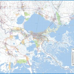
Wall map of the New Orleans Metro Area showing locations within 45 – 60 miles of downtown New Orleans, including the area from Baton Rouge to Gulfport, south to the Gulf. The map covers much of East Baton Rouge Parish, Livingston Parish, southern Tangipahoa Parish, St. Tammany Parish, Ascension Parish, St. James Parish, St. John the…
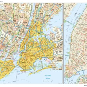
This detailed reference map combines two maps in one – a regional map of New York that includes all five boroughs and northeastern New Jersey plus a street-level map of Midtown and Lower Manhattan. The regional map – including all of Manhattan, Brooklyn, Queens, Bronx, and Staten Island – shows the area s cities and…
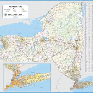
Wall map of New York, showing counties, towns, cities, villages, major roads and highways. Includes community index. This map comes in a variety of sizes and finishing options. It is shipped rolled in a sturdy cardboard tube.
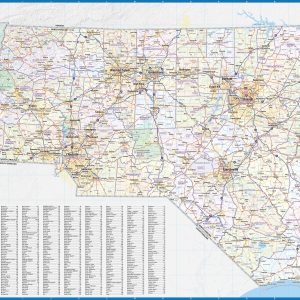
Wall map of North Carolina, showing counties, towns, cities, villages, major roads and highways. A community index is included. This map comes in a variety of sizes and finishing options. It is shipped rolled in a sturdy cardboard tube.
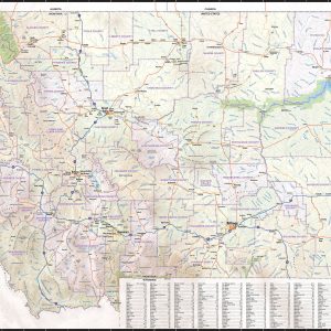
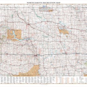
North Dakota is traversed by east to west by I-94 from Fargo to Theodore Roosevelt National Park and the Little Missouri National Grassland. This wall map highlights road and recreation details including park & monuments, boating & fishing access, campgrounds, historic sites, and more. If outdoor adventure and recreation is your thing, this is the…