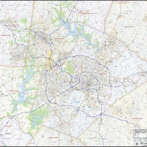
Our Research Triangle Area wall map shows a 50 mile by 45 mile area comprising the Raleigh – Durham – Chapel Hill region of North Carolina. The map shows towns, counties, major and secondary highways and routes, as well as major points of interest. Note: due to the vast extent of this map, local street…
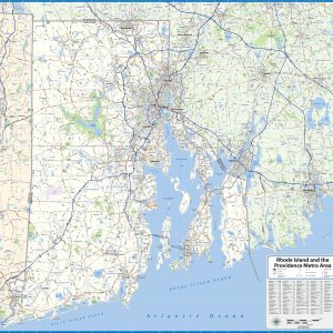
Our Rhode Island and the Providence Metro Area wall map shows a 50 mile by 50 mile area including all of the State of Rhode Island as well as nearby parts of Massachusetts and Connecticut. The communities of Providence, Pawtucket, Cranston, Woonsocket, Attleboro, Taunton, Fall River, New Bedford, Newport, Westerly, and Warwick are shown, among…
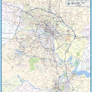
Our Richmond Metro Area wall map shows the area within 15 miles of downtown Richmond, including the communities of Tuckahoe, Mechanicsville, Midlothian, Petersburg, Brandermill, Meadowbrook, Short Pump, Glen Allen, Ashland, and Highland Springs, among others. Features shown include cities, towns, counties, highways and major and secondary roads, zip codes, and major points of interest. Note:…
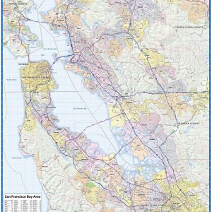
Our San Francisco Bay Area map shows the entire San Francisco – San Jose – Silicon Valley – Bay Area of California This exquisite wall map of San Francisco uses shaded relief to portray the land and combines shading with elevation tints that portray landforms much more clearly than contour lines. These techniques and elevation colors…
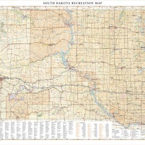
South Dakota is home to the famous Black Hills National Forest and Mount Rushmore National Monument, iconic attractions for road travelers around the world. This map illustrates the public lands and recreation potential of South Dakota, from Deadwood and Sturgis to its eastern capital in Sioux Falls. If outdoor adventure and recreation is your thing,…
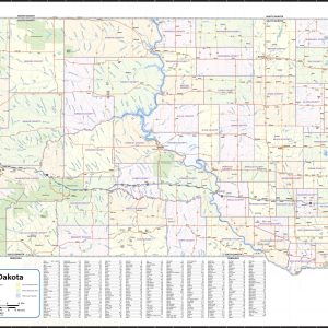
Wall map of South Dakota, showing counties, towns, cities, villages, major roads and highways. Includes community index. This map comes in a variety of sizes and finishing options. It is shipped rolled in a sturdy cardboard tube.
This beautiful antique map reproduction is printed on heavy acid-free stock with fade proof inks and is excellent for framing. Copyright U.S.G.S., 1965 Size: 39 × 34
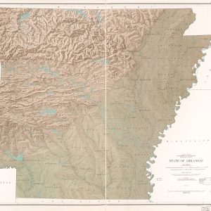
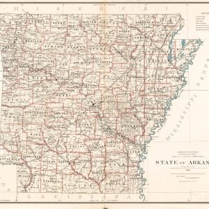
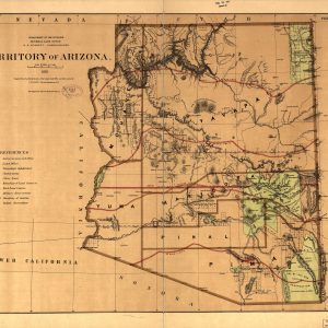
This beautiful antique map reproduction is printed on heavy acid-free stock with fade proof inks and is excellent for framing. Copyright Department of the Interior, 1886 Size: 37 × 28
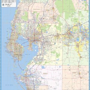
Our Tampa Bay Area wall map shows the area within 40 miles of downtown Tampa, including the communities of St Petersburg, Clearwater, Largo, Sarasota, Brandon, Riverview, Palm Harbor, Spring Hill, Bradenton, Pinellas Park, and Dunedin, as well as Hernando County, Pasco County, Pinellas County, Hillsborough County, Manatee County, and parts of Sarasota County, Desoto County,…
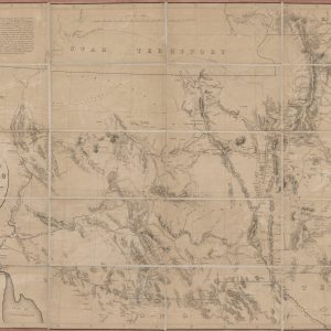
This historic map reproduction is printed on heavy acid-free stock with fade proof inks and is excellent for framing. The map covers territory between Utah and Mexico, from the Colorado River to the Liano Estacado; shows trails and wagon roads, forts, expeditions and explorations of the Southwest; names places and known rivers and mountain ranges….
This beautiful antique map is printed on heavy acid-free stock with fade proof inks and is excellent for framing. Copyright U.S. General Land Office, 1876 Size: 30 × 25
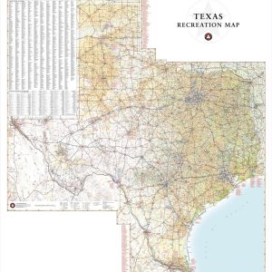
Texas has a reputation for big country, big cities, and Big Bend National Park. This wall map illustrates the vast countryside and recreation attractions throughout The Lone Star State, from Gulf Coast and fields of Blue Bonnets in the east to the panhandle’s Palo Duro Canyon and the Guadalupe Mountains in the west. If outdoor…
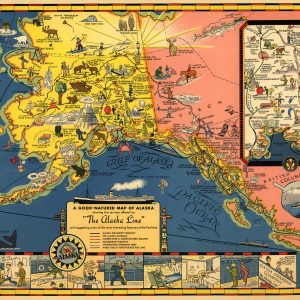
This beautiful antique tourist map reproduction is printed on heavy acid-free stock with fade proof inks. It is colorful, beautifully illustrated, and excellent for framing. Copyright 1934, Alaska Steamship Company Size: 29 × 22
Cool off this Summer with one of these 30 delectable Rooiobos Iced Tea refreshers. This ultimate handbook contains 30 fun Freshpak-based refreshers + 5 bonus recipes for mouth-watering frozen lollies What s Inside? 30+ unique rooibos refresher recipes 5 bonus frozen rooibos lolly recipes 3 surprise cold-comfort recipes How Do Preorders Work? When you preorder this item,…
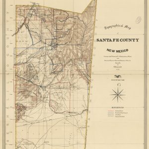
Beautiful antique topographic map reproduction of Santa Fe County, New Mexico. Topographic relief is shown using hachures. This map is printed on heavy acid-free stock with fade proof inks. It is perfect for framing. Copyright 1883, by Arthur Boyle Size: 28 × 35
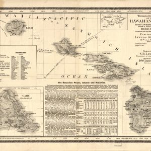
This beautiful antique map reproduction is printed on heavy acid-free stock with fade proof inks and is excellent for framing. Relief on the map is shown using hachures and spot heights. The map includes text featuring Hawaiian vocabulary and statistical information. Copyright Linton & Garrigues, 1893 Size: 27 × 19