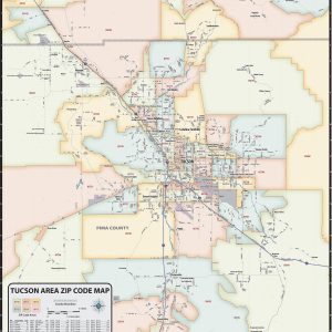
Our Tucson Metro Area ZIP Code Map highlights zip code areas within Tucson region of Arizona. The perfect tool for visualizing the big picture for the entire Tucson Metro area, each zip code is colorized and labeled for quick identification. The map also shows counties, communities, and major roads. An index of zip codes is…
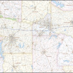
Our Tyler – Longview – Marshall Area wall map shows a 90 mile wide by 60 mile high area of eastern Texas. Besides Tyler, Longview, and Marshall, the communities of Jacksonville, Lindale, Mineola, Gilmer, Kilgore, Carthage, and Henderson are shown. The map shows towns, counties, major and secondary highways and routes, as well as major…
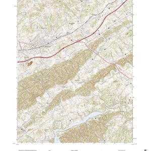
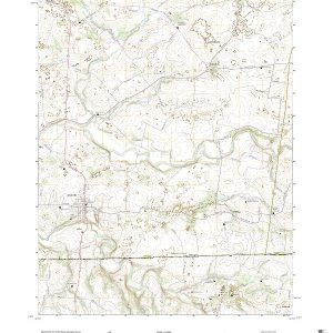
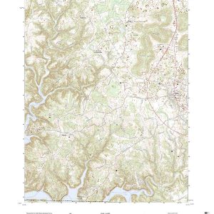
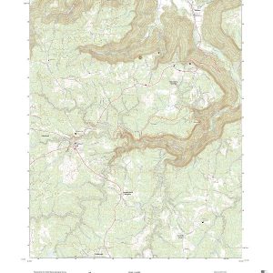
This is the current USGS topographic map for this quadrangle. Printed on waterproof, crease resistant paper, using HP fade resistant inks, this map comes rolled and shipped in a sturdy carboard tube. The map contains contour data, water features, roads and other features. Scale is 1:24,000. Printed size is 24 W x 29 H
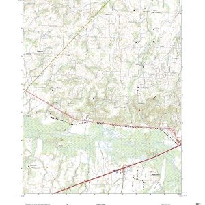
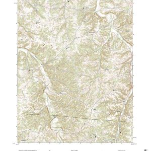
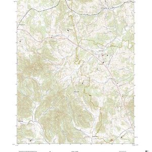
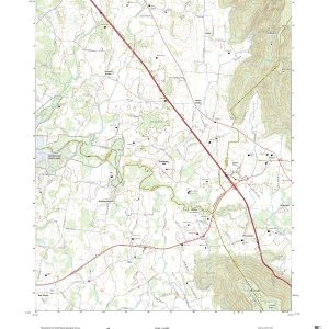
This is the current USGS topographic map for this quadrangle. Printed on waterproof, crease resistant paper, using HP fade resistant inks, this map comes rolled and shipped in a sturdy carboard tube. The map contains contour data, water features, roads and other features. Scale is 1:24,000. Printed size is 24 W x 29 H
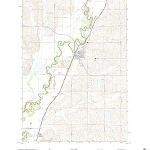
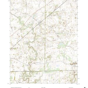
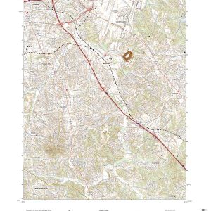
This is the current USGS topographic map for this quadrangle. Printed on waterproof, crease resistant paper, using HP fade resistant inks, this map comes rolled and shipped in a sturdy carboard tube. The map contains contour data, water features, roads and other features. Scale is 1:24,000. Printed size is 24 W x 29 H
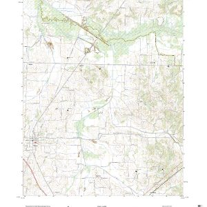
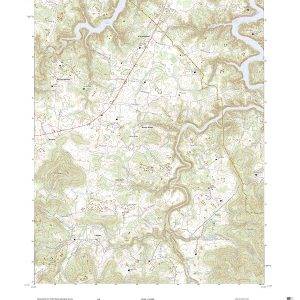
This is the current USGS topographic map for this quadrangle. Printed on waterproof, crease resistant paper, using HP fade resistant inks, this map comes rolled and shipped in a sturdy carboard tube. The map contains contour data, water features, roads and other features. Scale is 1:24,000. Printed size is 24 W x 29 H
This is the current USGS topographic map for this quadrangle. Printed on waterproof, crease resistant paper, using HP fade resistant inks, this map comes rolled and shipped in a sturdy carboard tube. The map contains contour data, water features, roads and other features. Scale is 1:24,000. Printed size is 24 W x 29 H
This is the current USGS topographic map for this quadrangle. Printed on waterproof, crease resistant paper, using HP fade resistant inks, this map comes rolled and shipped in a sturdy carboard tube. The map contains contour data, water features, roads and other features. Scale is 1:24,000. Printed size is 24 W x 29 H
This is the current USGS topographic map for this quadrangle. Printed on waterproof, crease resistant paper, using HP fade resistant inks, this map comes rolled and shipped in a sturdy carboard tube. The map contains contour data, water features, roads and other features. Scale is 1:24,000. Printed size is 24 W x 29 H
This is the current USGS topographic map for this quadrangle. Printed on waterproof, crease resistant paper, using HP fade resistant inks, this map comes rolled and shipped in a sturdy carboard tube. The map contains contour data, water features, roads and other features. Scale is 1:24,000. Printed size is 24 W x 29 H
This is the current USGS topographic map for this quadrangle. Printed on waterproof, crease resistant paper, using HP fade resistant inks, this map comes rolled and shipped in a sturdy carboard tube. The map contains contour data, water features, roads and other features. Scale is 1:24,000. Printed size is 24 W x 29 H
This is the current USGS topographic map for this quadrangle. Printed on waterproof, crease resistant paper, using HP fade resistant inks, this map comes rolled and shipped in a sturdy carboard tube. The map contains contour data, water features, roads and other features. Scale is 1:24,000. Printed size is 24 W x 29 H
This is the current USGS topographic map for this quadrangle. Printed on waterproof, crease resistant paper, using HP fade resistant inks, this map comes rolled and shipped in a sturdy carboard tube. The map contains contour data, water features, roads and other features. Scale is 1:24,000. Printed size is 24 W x 29 H
This is the current USGS topographic map for this quadrangle. Printed on waterproof, crease resistant paper, using HP fade resistant inks, this map comes rolled and shipped in a sturdy carboard tube. The map contains contour data, water features, roads and other features. Scale is 1:24,000. Printed size is 24 W x 29 H
This is the current USGS topographic map for this quadrangle. Printed on waterproof, crease resistant paper, using HP fade resistant inks, this map comes rolled and shipped in a sturdy carboard tube. The map contains contour data, water features, roads and other features. Scale is 1:24,000. Printed size is 24 W x 29 H
This is the current USGS topographic map for this quadrangle. Printed on waterproof, crease resistant paper, using HP fade resistant inks, this map comes rolled and shipped in a sturdy carboard tube. The map contains contour data, water features, roads and other features. Scale is 1:24,000. Printed size is 24 W x 29 H