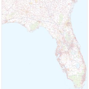
This map of Florida shows ZIP codes overlaid on a road map. Base map features include county boundaries, major road network features, and state and national parks and conservation areas. This map is rolled and shipped in a sturdy cardboard tube.
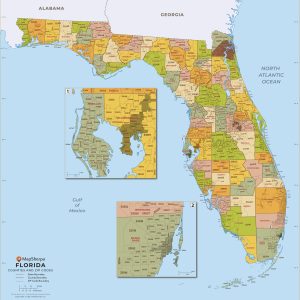
This map has been created and designed for business or reference use. Clear and clean colors & fonts matched with cartographic research makes this Florida Zip Code Map with Counties easily readable and useful. The map shows the 67 counties of Florida and the borders of the over 900 zip codes across the Sunshine State….
Floridae Americae provinciae… 1591 This beautiful antique map reproduction is printed on heavy acid-free stock with fade proof inks and is excellent for framing. 20 W x 16 H
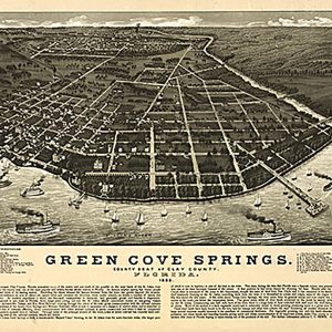
Green Cove Springs, county seat of Clay County, Florida, 1885 This beautiful antique map reproduction is printed on heavy acid-free stock with fade proof inks and is excellent for framing. 23 W x 16 H
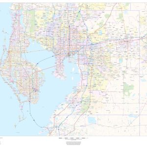
This map of Hillsborough County, Florida shows regional level information. Base map features include highways and major roads with labelling; railways; high level land use such as parks and recreation areas; and a selection of points of interest including transportation hubs like airports and train stations, tourist information and police stations. ZIP code boundaries are…
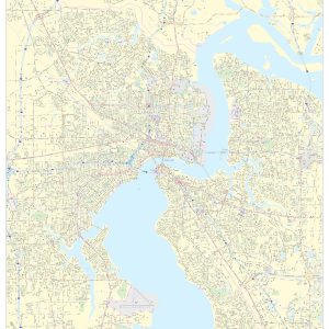
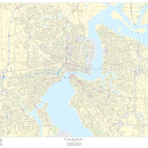
This portrait-oriented map of central Jacksonville, Florida shows detailed street level information including extensive street labeling. Ideal for planning of deliveries, home services, sales territories, real estate and much more. Base map features include all roads with major roads and highways labelled; neighborhood names; railways; high level land use such as parks and recreation areas,…
This portrait-oriented map of central Jacksonville, Florida shows detailed street level information including extensive street labeling. Ideal for planning of deliveries, home services, sales territories, real estate and much more. Base map features include all roads with major roads and highways labelled; neighborhood names; railways; high level land use such as parks and recreation areas,…
Jacksonville, Florida, 1893 This beautiful antique map reproduction is printed on heavy acid-free stock with fade proof inks and is excellent for framing. 35 W x 26 H
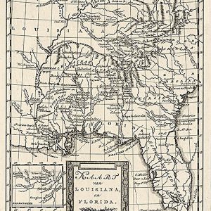
Kaart van Louisiana, en Florida 1785 This beautiful antique map reproduction is printed on heavy acid-free stock with fade proof inks and is excellent for framing. 12 W x 18 H
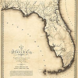
Map of Florida, 1823 This beautiful antique map reproduction is printed on heavy acid-free stock with fade proof inks and is excellent for framing. 23 W x 26 H
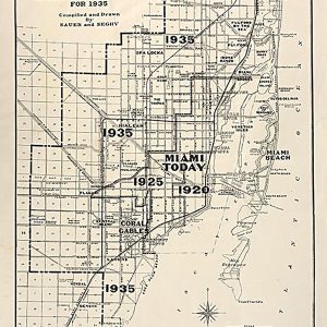
Map of the city of Miami and environs showing the greater Miami development and the estimated expansion for 1935 This beautiful antique map reproduction is printed on heavy acid-free stock with fade proof inks and is excellent for framing. 14 W x 25 H
Map of West Palm Beach, Lake Worth, and Palm Beach, Florida, 1907 This beautiful antique map reproduction is printed on heavy acid-free stock with fade proof inks and is excellent for framing. 26 W x 20 H
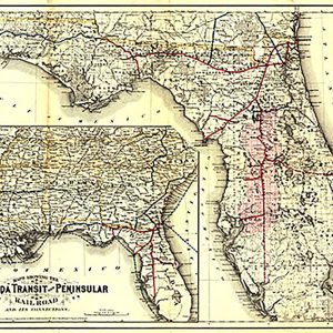
Maps showing the Florida Transit and Peninsula Rail Road and its connections, 1882 This beautiful antique map reproduction is printed on heavy acid-free stock with fade proof inks and is excellent for framing. 31 W x 22 H
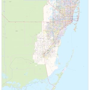
This map of Miami-Dade County, Florida shows regional level information. Base map features include highways and major roads with labelling; railways; high level land use such as parks and recreation areas; and a selection of points of interest including transportation hubs like airports and train stations, tourist information and police stations. ZIP code boundaries are…
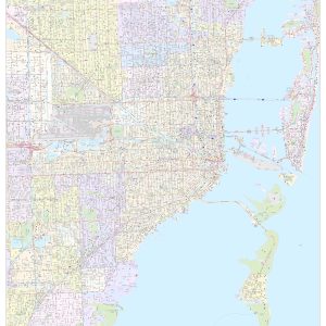
This portrait-oriented map of Miami, Florida shows detailed street level information including extensive street labeling. Ideal for planning of deliveries, home services, sales territories, real estate and much more. Base map features include all roads with major roads and highways labelled; neighborhood names; railways; high level land use such as parks and recreation areas, industrial…
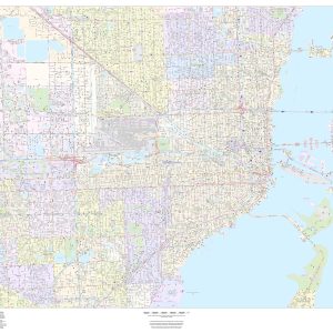
This landscape-oriented map of Miami, Florida shows detailed street level information including extensive street labeling. Ideal for planning of deliveries, home services, sales territories, real estate and much more. Base map features include all roads with major roads and highways labelled; neighborhood names; railways; high level land use such as parks and recreation areas, industrial…