Cadbury P.S. Caramilk, 48g Discount
$1.88Layers of wafer and caramel-flavoured cream smothered in delicious Caramilk.
FREE RETURNS. STANDARD SHIPPING ORDERS $99+
Showing 289–304 of 5124 results
Layers of wafer and caramel-flavoured cream smothered in delicious Caramilk.
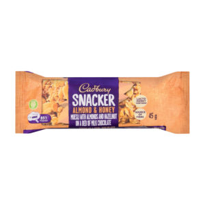
Snack on the go with this scrumptious snack bar. A source of fibre, it has a delicious layer of muesli, honey, almonds and hazelnuts on a decadent layer of chocolate. It s a perfect anytime treat!
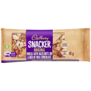
A tasty hunger-buster, this snack bar is filled with fruity crunch and flavour on a bed of milk chocolate. For a well-rounded, energy-boosting snack, try this bar with cranberry and raisin pieces, and chunks of muesli on a deliciously smooth bed of milk chocolate. Not only is it delicious in flavour, but it s a…
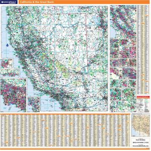
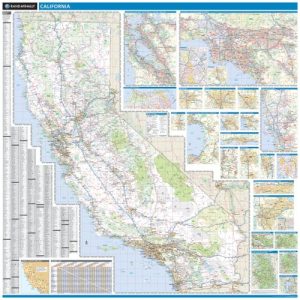
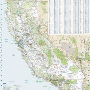
Laminated with Hanging Rails 60 W x 60 H Index of Counties and Cities Fully Indexed Counties, Cities, Mileage Chart Inset Maps of All Major Cities Coverage area includes all of California & Nevada and parts of AZ, CO, UT, ID, OR Free Shipping! This map is rolled and shipped in a sturdy cardboard tube.
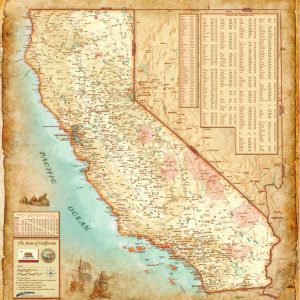
California Antique Wall Map Introducing the California Antique Wall Map Mural. Beautifully illustrated with subtle antique parchment and earth tone hues, the detail is highly legible with borders clearly defined. In this unique Antique style, this map can be used for general reference, to track current events, or as a piece of art. Decorators will find the…
Laminated with Hanging Rails 60 W x 60 H Index of Counties and Cities Fully Indexed Counties, Cities, Mileage Chart Inset Maps of All Major Cities Free Shipping! This map is rolled and shipped in a sturdy cardboard tube.
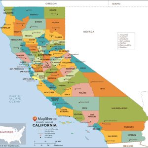
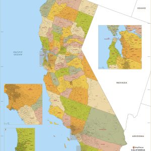
This map has been created and designed for reference or business use. Clear and clean colors & fonts matched with cartographic research makes this map of California Counties Map easily readable and useful. The map shows the 58 counties of California and their borders across the Golden State. This map is rolled and shipped in…
California Wall Map Introducing our Decorative California Wall Map Mural. Beautifully illustrated with subtle earth tone hues, the detail is highly legible with borders clearly defined. In classic Atlas style, this map can be used for general reference, to track current events, or as a piece of art. Decorators will find the color scheme works…
California Reference Wall Map Introducing our California Executive Wall Map. Beautifully illustrated, the detail is highly legible with borders clearly defined. In classic Atlas style, this map can be used for general reference, to track current events, or as a piece of art. With flexible sizes this mural is a designer s delight. This California…
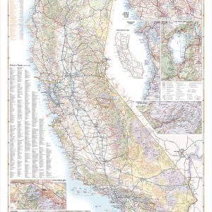
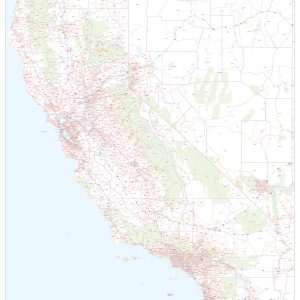
Few places in the world can claim such diverse landscapes and seascapes as California. This map illustrates The Golden State’s network of highways that grant road travelers access to iconic natural features like Death Valley, Lake Tahoe, Yosemite Valley, and the Coastal Redwoods to name a few. If outdoor adventure and recreation is your thing,…
California shown as an island by Joan Vinckeboons, c1650This beautiful antique map reproduction is printed on heavy acid-free stock with fade proof inks and is excellent for framing. 27 W x 19 H
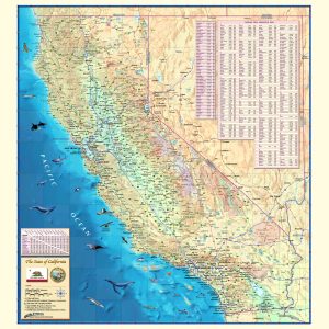
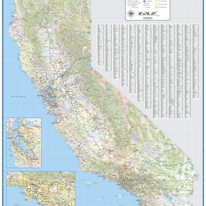
This colorful, easy-to-read state map of California identifies all major thoroughfares, secondary roads, freeway interchanges, distance markers, landmarks, recreational areas, and more. Shaded relief on the state map provides a three-dimensional sense of California’s topography. County and city indices make it simple to locate even the smallest town. This map is rolled and shipped in…
This exquisite wall map of California uses shaded relief to portray the land and combines shading with elevation tints that portray landforms much more clearly than contour lines. These techniques and elevation colors make mountains, highlands and valleys immediately obvious. Laminated wall map of California, showing counties, towns, cities, villages, major roads and highways. Includes…
This map of California shows ZIP codes overlaid on a road map. Base map features include county boundaries, major road network features, and state and national parks and conservation areas. This map is rolled and shipped in a sturdy cardboard tube.
This map has been created and designed for business or reference use. Clear and clean colors & fonts matched with cartographic research makes this California Zip Code Map with Counties easily readable and useful. The map shows the 58 counties of California and the borders of the over 1,700 zip codes across the Golden State….
End of content
End of content
No products in the cart.