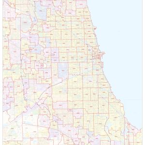
This map of Chicago shows ZIP code areas overlaid on a road map. Ideal for planning of deliveries, home services, sales territories, real estate and much more. Base map features include all roads with major roads and highways labelled; neighborhood names; railways; and high level land use such as parks and recreation areas, industrial areas…
Chicago, Central Business Section by Arno B. Reincke, 1916This beautiful antique map reproduction is printed on heavy acid-free stock with fade proof inks and is excellent for framing. 33 W x 20 H
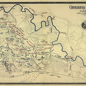
Chickamauga battlefield, Sept 19-20, 1863This beautiful antique map reproduction is printed on heavy acid-free stock with fade proof inks and is excellent for framing. 29 W x 19 H
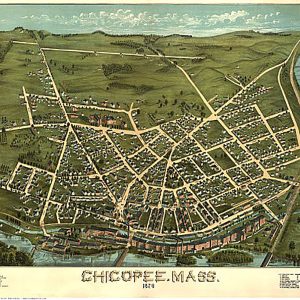
Chicopee, Mass. by D. Bremner & Co, 1878.This beautiful antique map reproduction is printed on heavy acid-free stock with fade proof inks and is excellent for framing. 23 W x 18 H
Rand McNally s regional wall map of Cincinnati Dayton is ideal for anyone needing a comprehensive representation of the area for planning, routing, or reference. It s a great choice for business and sales strategy, urban development, social work outreach, education, and marketing. Cincinnati and Dayton residents, businesses, and government offices are sure to find…
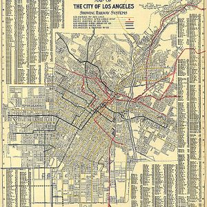
City of Los Angeles Showing Railway Systems, 1906This beautiful antique map reproduction is printed on heavy acid-free stock with fade proof inks and is excellent for framing. 22 W x 25 H
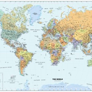
Paper or laminated National Capitals International Boundaries Major Physical Features Perfect for home, business, or school, this Classic World Wall Map combines warm, traditional colors with high-detailed cartography. Details on this World Wall Map include: international boundaries and nationalcapitals along with other major cities; major physical features such asmountain ranges, major mountain peaks, island chains, and…
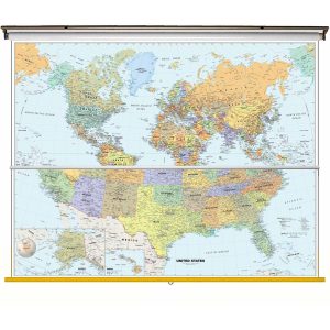
Size: 40 h x 63 w Finishing: Spring Roller Includes 2 Maps on One Spring Roller! Perfect for home, business, or school, this Classic USA Wall Map combines warm, attractive colors with high-detailed cartography. Details on this United States Wall Map include state boundaries and capitals along with other major cities and towns; major physical features such…
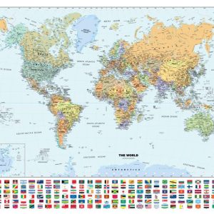
National Capitals and Flags International Boundaries Major Physical Features Perfect for home, business, or school, this Classic WorldWall Map with Flags combines warm, traditional colors with high-detailedcartography. Details on this World WallMap include: international boundariesand national capitals along with other major cities; major physical featuressuch as mountain ranges, major mountain peaks, island chains, and…
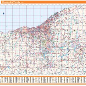
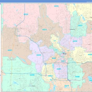
Rand McNally s regional wall map of Cleveland is ideal for anyone needing a comprehensive representation of the area for planning, routing, or reference. It s a great choice for business and sales strategy, urban development, social work outreach, education, and marketing. Cleveland residents, businesses, and government offices are sure to find this wonderful reference…
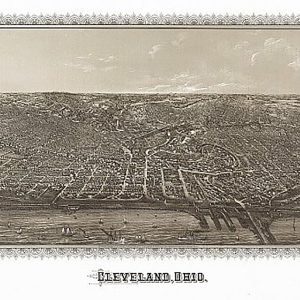
Cleveland, Ohio by C. H. Vogt & Son, 1887This beautiful antique map reproduction is printed on heavy acid-free stock with fade proof inks and is excellent for framing. 32 W x 22 H
From concrete, vinyl, tiles, Marley tiles, melamine and sealed wooden floors like oak, pine and beech, this lavender floor polish shines and protects everything. This 5-wax polish is simple to use, protects your floors from damage and cleans while leaving a spectacular sheen. Made in South Africa & Imported by Aubergine Foods. How to Use…
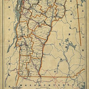
Coffin s new rail-road map of Vermont, 1896This beautiful antique map reproduction is printed on heavy acid-free stock with fade proof inks and is excellent for framing. 18 W x 23 H
Original English mustard makes any meal instantly delicious – this is a classic. Put a fiery helping on your roast, stir generously into your gravy or lash onto your sandwich.
Save money on our full line of wall maps from one of the industry leaders in wall maps. These always up to date, eye catching wall maps come in a variety of sizes and finishing options sure to meet your specific mapping needs. The Color Cast Style Wall Map is a multi-colored display that shades…
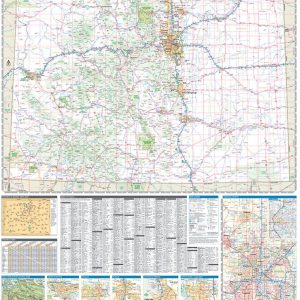
Laminated with Hanging Rails 46 W x 60 H Index of Counties and Cities Fully Indexed Counties, Cities, Mileage Chart Inset Maps of All Major Cities Free Shipping! This map is rolled and shipped in a sturdy cardboard tube.