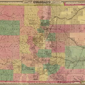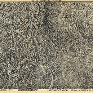

Colorado by the James Caxton Company, 1894 Online
$19.98Colorado by the James Caxton Company, 1894Colorado Caxton Co. ; drawn & lith. by Pezolt, F. Frank CREATED PUBLISHED Denver, James McConnell 1894. 36 W x 25 H
FREE RETURNS. STANDARD SHIPPING ORDERS $99+
Showing 369–384 of 5124 results
Colorado by the James Caxton Company, 1894Colorado Caxton Co. ; drawn & lith. by Pezolt, F. Frank CREATED PUBLISHED Denver, James McConnell 1894. 36 W x 25 H
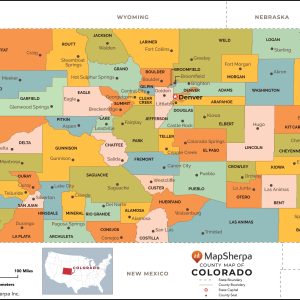
This map has been created and designed for reference or business use. Clear and clean colors & fonts matched with cartographic research makes this map of Colorado Counties Map easily readable and useful. The map shows the 64 counties of Colorado and their borders across the Centennial State. This map is rolled and shipped in…
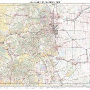
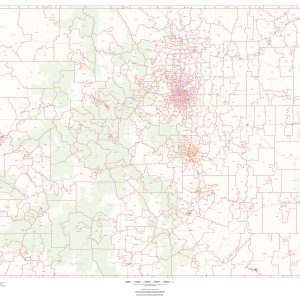
With its capital city Denver one mile above sea level (1,609 m), fifteen separate mountain ranges, and more than fifty peaks that reach above 14,000 ft (4,267 m), Colorado attracts travelers from around the world seeking their own “Rocky Mountain High” experience. This wall map illustrates The Centennial State’s vast network of highways and byways,…
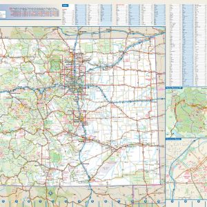
This colorful, easy-to-read state map of Colorado identifies all major thoroughfares, secondary roads, freeway interchanges, rest areas, distance markers, landmarks, recreational areas, and more. Shaded relief on the state map provides a three-dimensional sense of Colorado’s topography. Detailed city inset maps of Colorado Springs, Denver, Fort Collins, and Pueblo are based on the latest street…
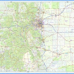
This exquisite wall map of Colorado uses shaded relief to portray the land and combines shading with elevation tints that portray landforms much more clearly than contour lines. These techniques and elevation colors make mountains, highlands and valleys immediately obvious. This map also includes a city index making this map both highly functional and decorative….
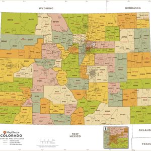
This map of Colorado shows ZIP codes overlaid on a road map. Base map features include municipality and county boundaries, major road network features, and state and national parks and conservation areas. This map is rolled and shipped in a sturdy cardboard tube.
This map has been created and designed for business or reference use. Clear and clean colors & fonts matched with cartographic research makes this Colorado Zip Code Map with Counties easily readable and useful. The map shows the 64 counties of Colorado and the borders of the over 500 zip codes across the Centennial State….
This beautiful antique map reproduction is printed on heavy acid-free stock with fade proof inks and is excellent for framing. The map features cities and towns, county boundaries, roads, and the railroad network. Copyright J.H. Colton & Co., 1855 Size: 17 × 27
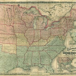
Colton s new railroad & county map of the United States, the Canadas &c., 1862This beautiful antique map reproduction is printed on heavy acid-free stock with fade proof inks and is excellent for framing. 29 W x 25 H
Colton s new sectional map of the State of Colorado.G.W. & C.B. Colton & Co.CREATED PUBLISHED New York : G.W. & C.B. Colton & Co., 1878. 34 W x 25 H
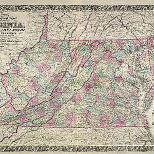
Colton s new topographical map of the states of Virginia, Maryland and Delaware, 1864This beautiful antique map reproduction is printed on heavy acid-free stock with fade proof inks and is excellent for framing. 38 W x 26 H
Colton s Railroad Map of Illinois, 1861This beautiful antique map reproduction is printed on heavy acid-free stock with fade proof inks and is excellent for framing. 33 W x 20 H
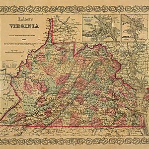
Colton s Virginia, 1862This beautiful antique map reproduction is printed on heavy acid-free stock with fade proof inks and is excellent for framing. 23 W x 19 H
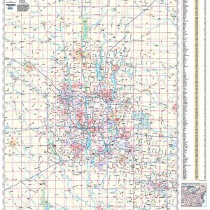
Rand McNally s regional wall map of Columbus is ideal for anyone needing a comprehensive representation of the area for planning, routing, or reference. It s a great choice for business and sales strategy, urban development, social work outreach, education, and marketing. Columbus residents, businesses, and government offices are sure to find this wonderful reference…
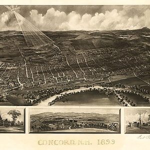
Concord, New Hampshire by A. F. Poole, 1899.This beautiful antique map reproduction is printed on heavy acid-free stock with fade proof inks and is excellent for framing. 22 W x 17 H
Laminated with Hanging Rails 60 W x 46 H Index of Counties and Cities Fully Indexed Counties, Cities, Mileage Chart Inset Maps of All Major Cities Free Shipping! This map is rolled and shipped in a sturdy cardboard tube.
End of content
End of content
No products in the cart.