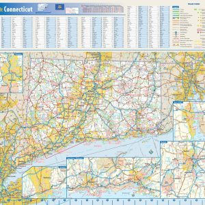
This colorful, easy-to-read state map of Connecticut identifies all major thoroughfares, secondary roads, freeway interchanges, rest areas, distance markers, landmarks, recreational areas, and more. Shaded relief on the state map provides a three-dimensional sense of Connecticut’s topography. Detailed city inset maps of Hartford, New Haven-Bridgeport, New London, Stamford, and Waterbury are based on the latest…
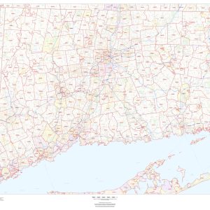
This map of Connecticut shows ZIP code areas overlaid on a road map. Ideal for planning of deliveries, home services, sales territories, real estate and much more. Base map features include all roads with major roads and highways labelled; municipality and county boundaries; neighborhood names; railways; and high level land use such as parks and…
National Capitals International Boundaries Major Physical Features Perfect for home, business, or school, this Contemporary World Wall Map combines bright, attractive colors with high-detailed cartography. Details on this World WallMap include: international boundaries and national capitals along with other major cities; major physical features such as mountain ranges, major mountain peaks, island chains, and deserts; and major water…
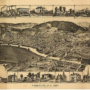
Corning, New York, 1882.This beautiful antique map reproduction is printed on heavy acid-free stock with fade proof inks and is excellent for framing. 25 W x 18 H
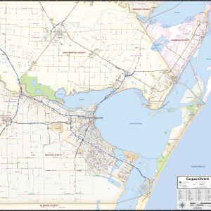
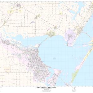
Our Corpus Christi Area wall map shows a 40 mile wide by 40 mile high area of south Texas. Besides Corpus Christi, the communities of Robstown, Odem, Sinton, Rockport, Ingleside, Portland, and Taft are shown. The map shows towns, counties, major and secondary highways and routes, as well as major points of interest. Note: due…
This up to date map of the Corpus Christi Regional area features up-to-date major roads, cities, highways, zip code boundaries, lakes, hospitals, high schools and more. Coverage area includes Corpus Christi, Aransas Pass, Port Aransas, Robstown and Padre Island
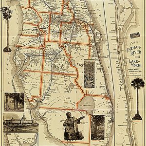
Correct map of Florida, season of 1894-5, showing the Tropical Trunk LineThis beautiful antique map reproduction is printed on heavy acid-free stock with fade proof inks and is excellent for framing. 18 W x 36 H
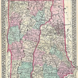
County and Township Map of the States of New Hampshire and Vermont by S. A. Mitchell, 1877.This beautiful antique map reproduction is printed on heavy acid-free stock with fade proof inks and is excellent for framing. 17 W x 27 H
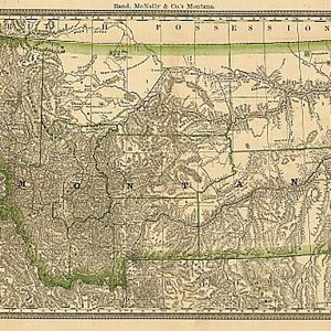
County map of Montana by Rand McNally and Company, 1881This beautiful antique map reproduction is printed on heavy acid-free stock with fade proof inks and is excellent for framing. 30 W x 20 H
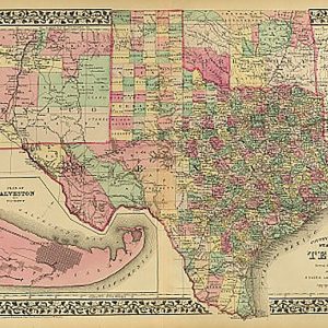
The mapmaking firm of S. A. Mitchell published this county map of Texas in 1881. At this time, Texas was experiencing explosive growth in terms of immigration and railroad development. The map was published in one of Mitchell’s popular commercial atlases, and clearly shows the steady westward movement of the Texas populace by charting county…
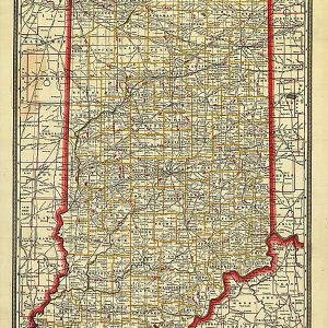
Cram s Township and Rail Road Map of Indiana, 1888This beautiful antique map reproduction is printed on heavy acid-free stock with fade proof inks and is excellent for framing. 22 W x 30 H
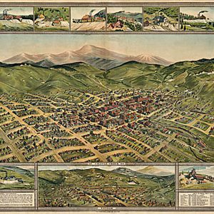
Cripple Creek, 1896. Phillips & Desjardins. CREATED PUBLISHED Denver, Western Litho. Co., c1896. This beautiful antique map reproduction is printed on heavy acid-free stock with fade proof inks and is excellent for framing. 33 W x 25 H
Use Crosse & Blackwell® Tangy Mayonnaise on your sandwiches, salads or any dish to add great flavor on your food. Made in South Africa & Imported by Aubergine Foods.
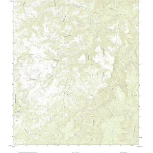
In 1879, the USGS began to map the Nation s topography. This mapping was done at different levels of detail in order to support various land use and other purposes. Current and historical versions for the entire United States are available here.The current versions are scaled at 1:24,000 also know as the 7.5 series. Each…