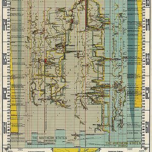
History of the Civil War in the United States, 1860-1865 by J. Kellick BathurstThis beautiful antique map reproduction is printed on heavy acid-free stock with fade proof inks and is excellent for framing. 26 W x 36 H
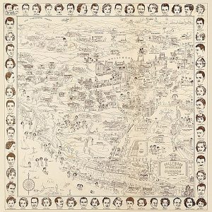
Hollywood starland official moviegraph of the land of stars, 1937This beautiful antique map reproduction is printed on heavy acid-free stock with fade proof inks and is excellent for framing. 25 W x 26 H
Home of the Hutchinson Family, High Rock, Lynn, Mass. by C.A. Shaw and H.J. Hutchinson, c1881This beautiful antique map reproduction is printed on heavy acid-free stock with fade proof inks and is excellent for framing. 26 W x 18 H
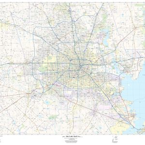
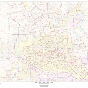
This up to date map of the Houston Regional area features up-to-date major roads, cities, highways, zip code boundaries, lakes, hospitals, high schools and more. Coverage area includes: North to include The Woodlands, West to include Sealy, South to include Galveston and East to include Liberty.
This map of Houston shows ZIP code areas overlaid on a road map. Ideal for planning of deliveries, home services, sales territories, real estate and much more. Base map features include all roads with major roads and highways labelled; neighborhood names; railways; and high level land use such as parks and recreation areas, industrial areas…
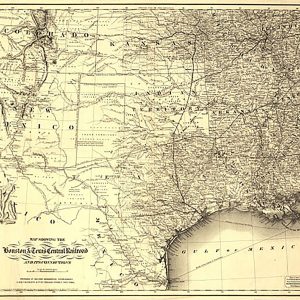
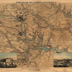
Hughes military map of Richmond & Petersburgh [sic], VA, 1864This beautiful antique map reproduction is printed on heavy acid-free stock with fade proof inks and is excellent for framing. 26 W x 30 H
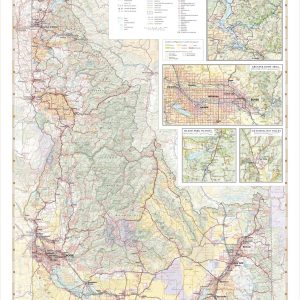
Laminated with Hanging Rails 46 W x 60 H Index of Counties and Cities Fully Indexed Counties, Cities, Mileage Chart Inset Maps of All Major Cities Free Shipping! This map is rolled and shipped in a sturdy cardboard tube.
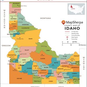
This map has been created and designed for reference or business use. Clear and clean colors & fonts matched with cartographic research makes this map of Idaho Counties Map easily readable and useful. The map shows the 44 counties of Idaho and their borders across the Gem State. This map is rolled and shipped in…
Idaho’s abundance of rare minerals, including the rare Star Garnet, earns it the nickname “The Gem State”. Idaho also boasts a wealth of mountain recreation and public lands including Craters of the Moon, Hells Canyon, the Sawtooth Mountains, and the western flanks of Yellowstone & Grand Teton National Parks. This wall map illustrates all the…
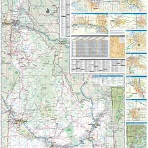
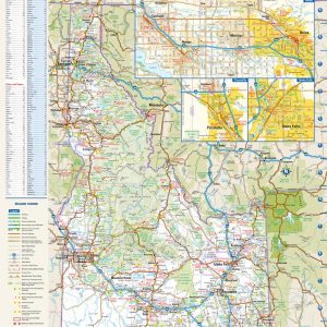
This colorful, easy-to-read state map of Idaho identifies all major thoroughfares, secondary roads, freeway interchanges, rest areas, distance markers, landmarks, recreational areas, and more. Shaded relief on the state map provides a three-dimensional sense of Idaho s topography. Detailed inset maps of Boise, Idaho Falls, and Pocatello are based on the latest street information from…
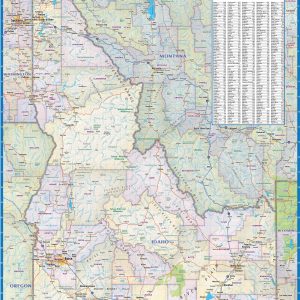
Wall map of Idaho, showing counties, towns, cities, villages, major roads and highways. A community index is included. Beautiful as well as functional this map will look great in a home, office, cabin, RV or wherever you choose to hang it. This map is rolled and shipped in a sturdy cardboard tube.
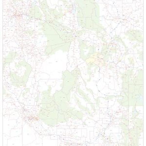
This map of Idaho shows ZIP codes overlaid on a road map. Base map features include county boundaries, major road network features, and state and national parks and conservation areas. This map is rolled and shipped in a sturdy cardboard tube.
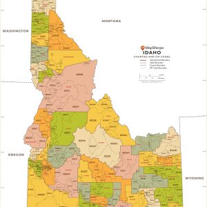
This map has been created and designed for business or reference use. Clear and clean colors & fonts matched with cartographic research makes this Idaho Zip Code Map with Counties easily readable and useful. The map shows the 44 counties of Idaho and the borders of the 278 zip codes across the Gem State. This…