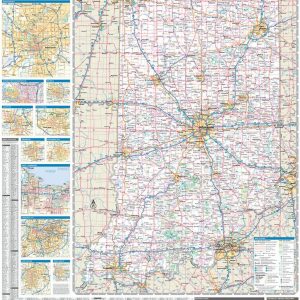
Laminated with Hanging Rails 46 W x 60 H Index of Counties and Cities Fully Indexed Counties, Cities, Mileage Chart Inset Maps of All Major Cities Free Shipping! This map is rolled and shipped in a sturdy cardboard tube.
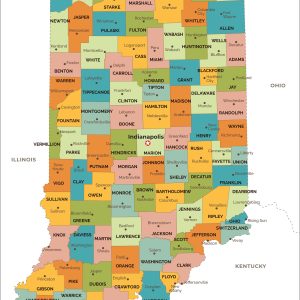
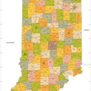
This map has been created and designed for reference or business use. Clear and clean colors & fonts matched with cartographic research makes this map of Indiana Counties Map easily readable and useful. The map shows the 92 counties of Indiana and their borders across the Hoosier State. This map is rolled and shipped in…
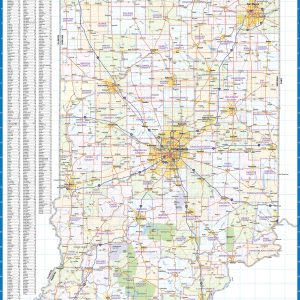
Laminated wall map of Indiana, showing counties, towns, cities, villages, major roads and highways. A community index is included. This map comes in a variety of sizes and finishing options. It is shipped rolled in a sturdy cardboard tube.
This colorful, easy-to-read state map of Indiana identifies all major thoroughfares, secondary roads, freeway interchanges, rest areas, distance markers, landmarks, recreational areas, and more. Shaded relief on the state map provides a three-dimensional sense of Indiana’s topography. Detailed city inset maps of Bloomington, Elkhart, Evansville, Fort Wayne, Indianapolis, Lafayette, Muncie, South Bend and Terre Haute…
This map of Indiana shows ZIP codes overlaid on a road map. Base map features include municipality and county boundaries, major road network features, and state and national parks and conservation areas. This map is rolled and shipped in a sturdy cardboard tube.
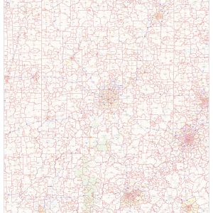
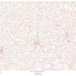
This map has been created and designed for business or reference use. Clear and clean colors & fonts matched with cartographic research makes this Indiana Zip Code Map with Counties easily readable and useful. The map shows the 92 counties of Indiana and the borders of the 773 zip codes across the Hoosier State. This…
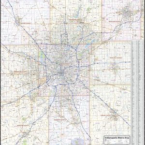
Our Indianapolis Metro Area wall map shows the area within 25 miles of downtown Indianapolis, Indiana, including Marion County and most of the counties of Boone, Hamilton, Madison, Hancock, Shelby, Johnson, Morgan, and Hendricks. The map shows towns, counties, major and secondary highways and routes, as well as major points of interest. Note: due to…
Ingram’s Camphor Cream has relieved the discomfort of dry skin in South Africa for over 65 years. With its non-greasy formula, and its ability to soothe, nourish and protect dry skin. This amazing product is now available in America. Ingram’s Camphor Cream will become essential to your daily routine. Try it and we are sure…
Ingram s Tissue Oil Cream 300ml is specially formulated with a blend of nourishing ingredients, like argan oil, Vitamin E, and Omega 3 & 6, to help replenish lost moisture and reinforce the skin barrier. Skin is left moisturized for up to 24 hours. Dermatologist approved. Ingram s skin-nourishing tissue oil cream is dermatologist-approved and…
Handmade figurine. These are known as little angels that will look after your loved ones. As a friend they will guide you through life. Each figurine is individually cast and painted by hand. 9.85 in height Handmade in Durban, South Africa
Laminated with Hanging Rails 60 W x 46 H Index of Counties and Cities Fully Indexed Counties, Cities, Mileage Chart Inset Maps of All Major Cities Free Shipping! This map is rolled and shipped in a sturdy cardboard tube.
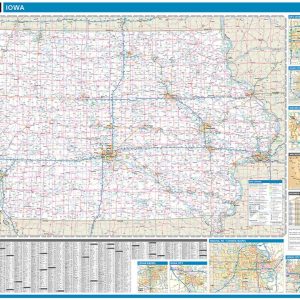
Wall map of Iowa, showing counties, towns, cities, villages, major roads and highways. A community index is included This map comes in a variety of sizes and finishing options. It is shipped rolled in a sturdy cardboard tube.
This colorful, easy-to-read state map of Iowa identifies all major thoroughfares, secondary roads, freeway interchanges, rest areas, distance markers, landmarks, recreational areas, and more. Shaded relief on the state map provides a three-dimensional sense of Iowa s topography. Detailed inset maps of Cedar Rapids, Des Moines, and Sioux City are based on the latest street…
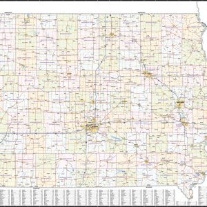
This map of Iowa shows ZIP codes overlaid on a road map. Base map features include municipality and county boundaries, major road network features, and state and national parks and conservation areas. This map is rolled and shipped in a sturdy cardboard tube.
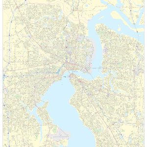
This portrait-oriented map of central Jacksonville, Florida shows detailed street level information including extensive street labeling. Ideal for planning of deliveries, home services, sales territories, real estate and much more. Base map features include all roads with major roads and highways labelled; neighborhood names; railways; high level land use such as parks and recreation areas,…