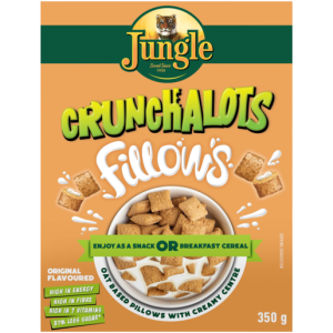
These oats are high in vitamins, iron and fibre, all of which are beneficial to your health. B-Vitamins aid in metabolism by assisting in the release of energy from carbs, lipids and proteins while Vitamin-A aids the immune system and Vitamin-D is required for proper bone strength maintenance.
These crunchy oat pillows combine delicious flavour with dietary fibre and vitamins, making it a quick and easy way to serve your family with a scrumptious and healthy breakfast. They make for a tasty treat between meals and a delicious pick-me-up in your lunch box. Chocolate flavoured breakfast cereal is always a crowd pleaser. These…
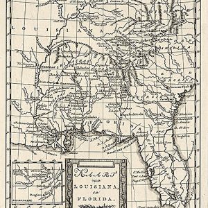
Kaart van Louisiana, en Florida 1785 This beautiful antique map reproduction is printed on heavy acid-free stock with fade proof inks and is excellent for framing. 12 W x 18 H
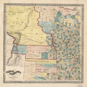
This beautiful antique map reproduction is printed on heavy acid-free stock with fade proof inks and is excellent for framing. The map also features Minnesota, Iowa, Missouri, Arkansas, Wisconsin, Illinois, and Native Territory. Relief on the map is shown using hachures. Copyright Morse & Gaston, 1856 Size: 23 × 23
Laminated with Hanging Rails 60 W x 46 H Index of Counties and Cities Fully Indexed Counties, Cities, Mileage Chart Inset Maps of All Major Cities Free Shipping!
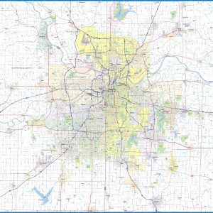
Kansas City Metro Area wall map, showing locations within 30 – 40 miles of downtown Kansas City. Information shown includes counties, towns, cities, major roads and highways, ZIP codes, and major points of interest. The area shown is from Lawrence, KS to Odessa, MO, and from Smithville to Harrisonville, MO. An index of community names…
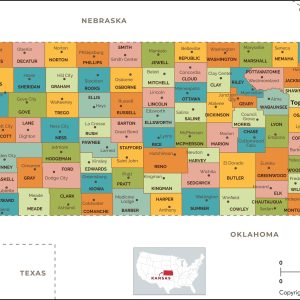
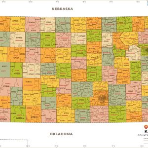
This map has been created designed for reference or business use. Clear and clean colors & fonts matched with cartographic research makes this map of Kansas Counties Map easily readable and useful. The map shows the 105 counties of Kansas and their borders across the Sunflower State. This map is rolled and shipped in a…
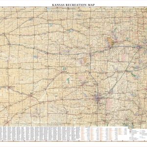
Kansas is best known for its rolling agricultural landscapes, which serve as host to a variety of flora and fauna. Fishing and migratory bird hunting are major recreational draws all year. This wall map beautifully illustrates the country roads that crisscross The Sunflower State, and the recreation opportunities that exist throughout. If outdoor adventure and…
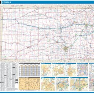
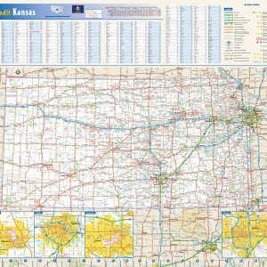
This colorful, easy-to-read state map of Kansas identifies all major thoroughfares, secondary roads, freeway interchanges, rest areas, distance markers, landmarks, recreational areas, and more. Shaded relief on the state map provides a three-dimensional sense of Kansas topography. Detailed inset maps of Lawrence, Manhattan, Topeka, and Wichita are based on the latest street information from our…
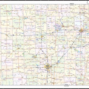
Wall map of Kansas, showing counties, towns, cities, villages, major roads and highways. A community index is included. This map is rolled and shipped in a sturdy cardboard tube.
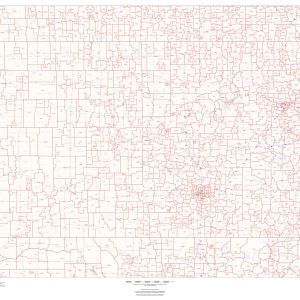
This map of Kansas shows ZIP codes overlaid on a road map. Base map features include municipality and county boundaries, major road network features, and state and national parks and conservation areas. This map is rolled and shipped in a sturdy cardboard tube.
This map has been created and designed for business or reference use. Clear and clean colors & fonts matched with cartographic research makes this Kansas Zip Code Map with Counties easily readable and useful. The map shows the 105 counties of Kansas and the borders of the 697 zip codes across the Sunflower State. This…
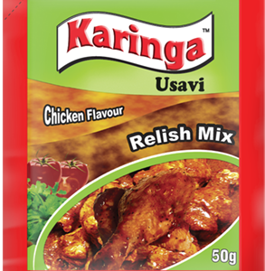
An alternative to Beef Usavi, piquant and savoury for a flavourful chicken stew. Usavi Relish Mix is a commonly used condiment in Zimbabwean dishes. It is used to add flavour and thickness to your meat and vegetable relishes. The most recent addition to our Usavi Relish Mix portfolio is the Karinga Beef & Onio
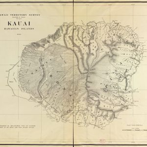
This beautiful antique map reproduction is printed on heavy acid-free stock with fade proof inks and is excellent for framing. Copyright Hawaii Territory Survey, 1903 Size: 47 × 37