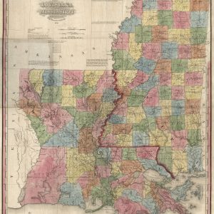

Louisiana and Mississippi, 1851 Fashion
$19.98This beautiful antique map reproduction is printed on heavy acid-free stock with fade proof ink and is perfect for framing. Copyright H.S. Tanner, 1851 Size: 22 × 28
FREE RETURNS. STANDARD SHIPPING ORDERS $99+
Showing 705–720 of 5124 results
This beautiful antique map reproduction is printed on heavy acid-free stock with fade proof ink and is perfect for framing. Copyright H.S. Tanner, 1851 Size: 22 × 28
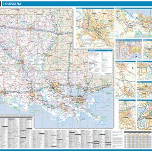
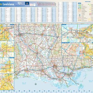
Laminated with Hanging Rails 60 W x 46 H Index of Counties and Cities Fully Indexed Counties, Cities, Mileage Chart Inset Maps of All Major Cities Free Shipping! This map is rolled and shipped in a sturdy cardboard tube.
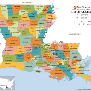
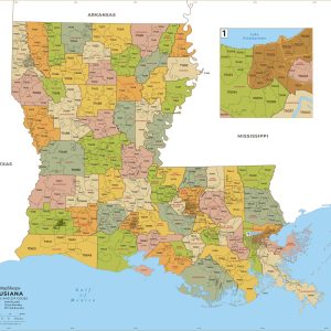
This map has been created designed for reference or business use. Clear and clean colors & fonts matched with cartographic research makes this map of Louisiana Parishes (Counties) Map easily readable and useful. The map shows the 64 parishes of Louisiana and their borders across the Pelican State. This map is rolled and shipped in…
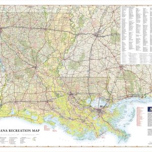
Rich with fishing and hunting opportunities in its diverse waters and expansive woodlands, Louisiana is truly a Sportsman’s Paradise. This wall map illustrates the physical features and recreation highlights of The Pelican State, from the northern Piney Hills to the Mississippi River Delta and Gulf Coast. If outdoor adventure and recreation is your thing, this…
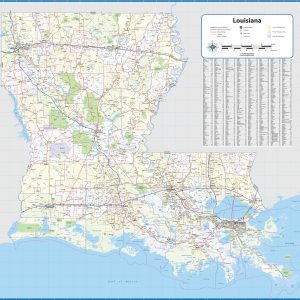
Laminated wall map of Louisiana, showing parishes, towns, cities, villages, hamlets, major roads and highways. Includes community index This map comes in a variety of sizes and finishing options. It is shipped rolled in a sturdy cardboard tube.
This colorful, easy-to-read state map of Louisiana identifies all major thoroughfares, secondary roads, freeway interchanges, rest areas, distance markers, landmarks, recreational areas, and more. Shaded relief on the state map provides a three-dimensional sense of Louisiana’s topography. Detailed city inset maps of Baton Rouge, Lafayette, Lake Charles, Monroe, and New Orleans are based on the…
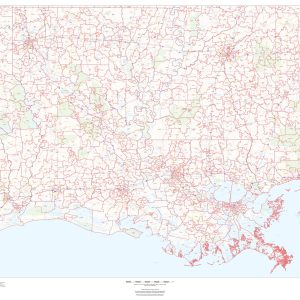
This map of Louisiana shows ZIP codes overlaid on a road map. Base map features include municipality and county boundaries, major road network features, and state and national parks and conservation areas. This map is rolled and shipped in a sturdy cardboard tube.
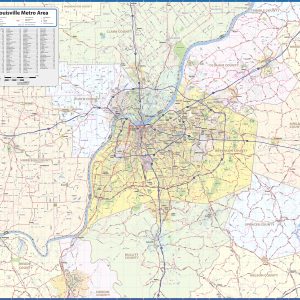
Our Louisville Metro Area wall map shows the area within 25 miles of downtown Louisville for areas both in Kentucky and Indiana, including the communities of Jeffersontown, Jeffersonville, New Albany, Clarksville, Lyndon, Mount Washington, St. Matthews, Shelbyville, Shepherdsville, and Shively, among others. All of Jefferson County, Oldham County, and Floyd County are shown, as well…
This map has been created and designed for business or reference use. Clear and clean colors & fonts matched with cartographic research makes this Louisiana Zip Code Map with Parishes (Counties) easily readable and useful. The map shows the 64 parishes of Louisiana and the borders of the 509 zip codes across the Pelican State….
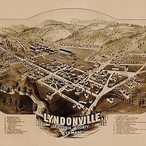
Lyndonville, Vermont by Geo. E. Norris, 1884This beautiful antique map reproduction is printed on heavy acid-free stock with fade proof inks and is excellent for framing. 23 W x 19 H
This White Porcelain Barnacle Candle Votive is Coconut Fig scented. Perfect as a Gift Box, this candle has been crafted and designed for you in Cape Town, South Africa by Madame Luna. Each Madame Luna candle is delicately blended to create unique and elegant fragrances. A local specialized candle pourer carefully hand-pours each and every…
These bright and colorful Nelson Mandela coasters celebrate our beloved Madiba. Made in Cape Town, South Africa. A great house warming or father s day gift. Sold in a set of 4.
Maggie Durban Curry Flavoured 2 Minute Noodles are a must-have for quick and tasty meals. Made with high-quality ingredients like sunflower seed oil which is low in saturated fats, these noodles are also fortified with iron and oat fibre. Save time making dinner after a busy day in the office with Maggie Durban Curry Flavoured…
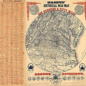
Magnus Historical War Map, One Hundred & Fifty Miles Around RichmondThis beautiful antique map reproduction is printed on heavy acid-free stock with fade proof inks and is excellent for framing. 27 W x 29 H
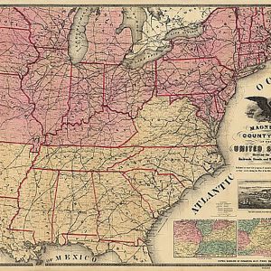
Magnus s county map of the United States during the War of the Rebellion, 1862This beautiful antique map reproduction is printed on heavy acid-free stock with fade proof inks and is excellent for framing. 33 W x 25 H
End of content
End of content
No products in the cart.